🥾 Hiking
Hiking weather, scored for the trail
A good hiking day needs everything to line up: dry, not too hot, not too cold, not too windy up top. BlockCast weighs them almost evenly for hiking and scores every block of your week, so the big hike goes on the one day that checks every box.
Free. No account, no ads, no tracking. iPhone, iPad and any web browser.
What BlockCast checks for hiking
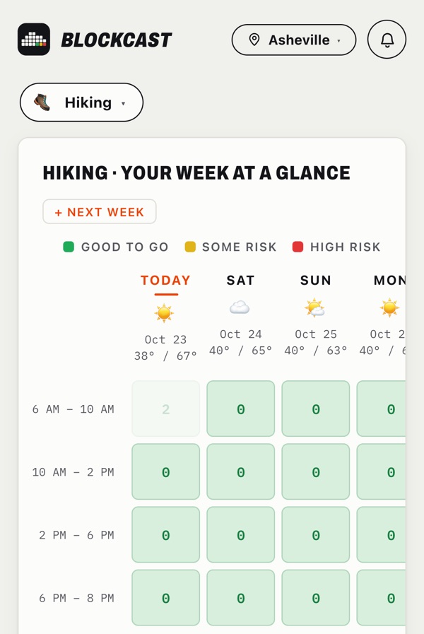
Every block gets a risk score from 0 to 100: green under 25, yellow under 55, red above. The worst factor drives the score and the others add to it. These are the default weights; you can change any of them in the app under Adjust.
Comfortable feels-like temperature: 2 to 28 °C (36 to 82 °F). Wind adds risk from 20 km/h (12 mph) sustained or 38 km/h (24 mph) in gusts.
How it works
- Pick hiking and your spot. Use your location or search any place in the world, and save up to three.
- Read your week at a glance. Choose 2, 3, 4 or 6 hour blocks and the hours you actually play. Tap any block for the hour-by-hour detail and the reason behind its colour.
- Plan it and stop checking. Add the session to your planner and your calendar. BlockCast re-checks every forecast and tells you if a planned session turns bad.
Hiking weather questions
What weather is too dangerous for hiking?
Thunderstorms, strong wind on exposed ridges, and cold rain are the classic hazards, along with heat on long climbs. BlockCast flags rain, wind, gusts, cold and heat in its score, but always check your local alerts before an exposed route; the Today view shows official warnings from Environment Canada and the US National Weather Service.
Does BlockCast forecast the summit?
It forecasts the point you choose. Drop the pin on the trailhead or the summit from the location search, and save up to three spots.
What is the best time of day to hike?
In summer, early starts beat heat, UV and afternoon storms. Use 4 or 6 hour blocks to see the whole outing in one square.
Where the data comes from
Forecasts come from Open-Meteo. Rain is the wettest of three models (the local best match, ECMWF and Canada’s GEM), so a green block means they all agree. Radar is the North American composite from Environment and Climate Change Canada; official alerts come from Environment Canada and the US National Weather Service.